


Users Will Always Have the Earliest Information
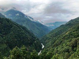
By combining all three alert systems into one layer, we are harnessing the different timing of the satellites to increase the chances of getting an unobscured look at the forest and therefore detect change faster. Users looking at integrated alerts in Peru from 2020 would have been alerted to forest loss on average 11 days earlier than by referring to any one system alone. This improvement in timeliness varies by region and across seasons, as the alert systems complement each other by providing their own strengths. For example, in consistently cloud-covered areas, the radar-based alert system provides the advantage of detecting forest loss through clouds. In areas with a regular dry season, however, the higher revisit time of the optical alert systems gives a more frequent opportunity to detect disturbances every 5-8 days where the radar system may take up to 12 days to detect change. 2. The Overlap of Multiple Systems Increases Confidence to Prioritize Alerts If two or more alert systems detect a change in the same location, we have the highest confidence that these alerts indicate real disturbance. For individual systems, there is a delay before a first detection can be verified by additional satellite passes and thus reach “high confidence”. The integrated layer displays where multiple systems overlap, providing increased confidence faster than waiting for individual systems to reach high confidence through additional satellite images, which can take weeks or months. For forest monitors who rely on high confidence alerts to respond to deforestation events, we hope this new layer facilitates using the various alert systems in conjunction with one another and can promote faster follow up by identifying these highest confidence alerts as soon as a second system detects the same disturbance. 3. Different Tree Cover Loss Types Are Captured Across a Variety of Landscapes The integrated alerts option helps to fill the gaps that the use of any one system alone might present. One of the greatest strengths of higher resolution RADD and GLAD-S2 alerts is their ability to capture smaller changes in the forest than the 30-meter GLAD-L product. This presents promising developments for detecting small canopy gaps from logging activities, which are widespread across the Amazon Basin. Now that all three systems are available in the Amazon basin, they can be used in concert to identify illegal activities quickly and with the highest confidence possible, a critical tool for both law enforcement and Indigenous Peoples and local communities working to combat deforestation.a